| Print Date: Feb 18 2016 | Country: |
| Description Date: Jul 30 2015 | State: Alaska |
| Describer: J Paul | County: Southeast Fairbanks Census Area |
| Site ID: S2015AK240001 | MLRA: 229 -- Interior Alaska Lowlands |
| Site Note: | Soil Survey Area: AK683 -- Fort Greely and Donnelly Training Area, Alaska |
| Pedon ID: S2015AK240001 | Map Unit: |
| Pedon Note: | Quad Name: |
| Lab Source ID: KSSL | Std Latitude: 63.8797130 |
| Lab Pedon #: 15N0739 | Std Longitude: -145.4746630 |
| User Transect ID: | |
| Soil Name as Described/Sampled: SND | |
| Classification: Coarse-loamy, mixed, superactive Typic Haplocryepts | Latitude: |
| Soil Name as Correlated: | Longitude: |
| Classification: | Datum: WGS84 |
| Pedon Type: | UTM Zone: |
| Pedon Purpose: | UTM Easting: |
| Taxon Kind: taxon above family | UTM Northing: |
| Associated Soils: |
| Physiographic Division: | Primary Earth Cover: |
| Physiographic Province: | Secondary Earth Cover: |
| Physiographic Section: | Existing Vegetation: |
| State Physiographic Area: | Parent Material: |
| Local Physiographic Area: | Bedrock Kind: |
| Geomorphic Setting: upper alluvial fan | Bedrock Depth: |
| Upslope Shape: linear | Bedrock Hardness: |
| Cross Slope Shape: convex | Bedrock Fracture Interval: |
| Particle Size Control Section: | Surface Fragments: |
| Description origin: NASIS | Description database: KSSL |
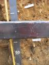
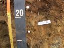
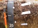
 D19_DEJU_Profile_000-300.JPG