| Print Date: Jul 22 2015 | Country: United States |
| Description Date: Apr 29 2013 | State: Alabama |
| Describer: Lawrence McGhee | County: Greene |
| Site ID: S2013AL063001 | MLRA: 133A -- Southern Coastal Plain |
| Site Note: | Soil Survey Area: AL063 -- Greene County, Alabama |
| Pedon ID: S2013AL063001 | Map Unit: |
| Pedon Note: | Quad Name: Demopolis, Alabama |
| Lab Source ID: SSL | Std Latitude: 32.5410000 |
| Lab Pedon #: 13N49390 | Std Longitude: -87.8031667 |
| User Transect ID: | |
| Soil Name as Described/Sampled: Angie | |
| Classification: Fine, mixed, semiactive, thermic Aquic Paleudults | Latitude: 32 degrees 32 minutes 27.60 seconds north |
| Soil Name as Correlated: | Longitude: 87 degrees 48 minutes 11.40 seconds west |
| Classification: | Datum: NAD83 |
| Pedon Type: confirmation description | UTM Zone: 16 |
| Pedon Purpose: research site | UTM Easting: 424584 meters |
| Taxon Kind: series | UTM Northing: 3600688 meters |
| Associated Soils: |
| Physiographic Division: | Primary Earth Cover: Tree cover |
| Physiographic Province: | Secondary Earth Cover: |
| Physiographic Section: | Existing Vegetation: |
| State Physiographic Area: | Parent Material: Fine textured alluvium and marine sediments |
| Local Physiographic Area: | Bedrock Kind: |
| Geomorphic Setting: microhigh on toeslope of tread of flood plain | Bedrock Depth: |
| Upslope Shape: linear | Bedrock Hardness: |
| Cross Slope Shape: linear | Bedrock Fracture Interval: |
| Particle Size Control Section: 27 to 77 cm. | Surface Fragments: |
| Description origin: NASIS | Description database: KSSL |
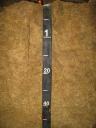
 D08_DELA_Profile_080-155.JPG
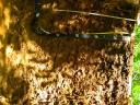