D11 OAES Megapit Soils Description


PEDON DESCRIPTION
Print Date: Jul 22 2015 Country: United States
Description Date: Feb 19 2013 State: Oklahoma
Describer: Tyson G. Morley County: Washita
Site ID: S2013OK149001 MLRA: 78C -- Central Rolling Red Plains, Eastern Part
Site Note: Soil Survey Area: OK149 -- Washita County, Oklahoma
Pedon ID: S2013OK149001 Map Unit:
Pedon Note: Quad Name:
Lab Source ID: SSL Std Latitude: 35.4105883
Lab Pedon #: 13N2558 Std Longitude: -99.0604367
User Transect ID:  
Soil Name as Described/Sampled:  
Classification: Latitude: 35 degrees 24 minutes 38.12 seconds north
Soil Name as Correlated: Longitude: 99 degrees 3 minutes 37.57 seconds west
Classification: Datum: WGS84
Pedon Type: UTM Zone: 14
Pedon Purpose: research site UTM Easting: 494513 meters
Taxon Kind: UTM Northing: 3918579 meters
Associated Soils:
Physiographic Division: Primary Earth Cover: Grass/herbaceous cover
Physiographic Province: Secondary Earth Cover: Savanna rangeland
Physiographic Section: Existing Vegetation: broom snakeweed, curlycup gumweed, plantain, prairie threeawn, pricklypear
State Physiographic Area: Parent Material:
Local Physiographic Area: Bedrock Kind: siltstone
Geomorphic Setting: on backslope of None Assigned Bedrock Depth:
Upslope Shape: convex Bedrock Hardness: very strongly cemented
Cross Slope Shape: convex Bedrock Fracture Interval:
Particle Size Control Section: 0 to 20 cm. Surface Fragments:
Description origin: Description database: KSSL
Diagnostic Features: ochric epipedon 0 to 8 cm.
paralithic contact 20 to 46 cm.
lithic contact 46 to cm.
 
Top Depth (cm) Bottom Depth (cm) Restriction Kind Restriction Hardness
20 46 bedrock, paralithic moderately cemented
46   bedrock, lithic very strongly cemented


Cont. Site ID: S2013OK149001 Pedon ID: S2013OK149001


Slope (%) Elevation (meters) Aspect (deg) MAAT (C) MSAT (C) MWAT (C) MAP (mm) Frost-Free Days Drainage Class Slope Length (meters) Upslope Length (meters)
4.5 515.0 320 15.0       211      

A--0 to 8 centimeters (0.0 to 3.1 inches); dark reddish brown (2.5YR 3/4) silt loam, reddish brown (2.5YR 4/4), dry; 14 percent sand; 58 percent silt; 18 percent clay; strong fine granular structure; loose, loose, slightly sticky, slightly plastic; many very fine roots throughout and common fine roots throughout; 2 percent nonflat angular weakly cemented 2 to 25-millimeter siltstone fragments; very slight effervescence, by HCl, 1 normal; clear smooth boundary. Lab sample # 13N03208

Bw--8 to 20 centimeters (3.1 to 7.9 inches); reddish brown (2.5YR 4/4) extremely gravelly silt loam, reddish brown (2.5YR 4/4), dry; 14 percent sand; 58 percent silt; 18 percent clay; weak fine granular structure; loose, loose, slightly sticky, slightly plastic; many very fine roots throughout and common fine roots throughout; 90 percent nonflat angular weakly cemented 2 to 20-millimeter siltstone fragments; slight effervescence, by HCl, 1 normal; abrupt smooth boundary. Lab sample # 13N03209

Cr1--20 to 31 centimeters (7.9 to 12.2 inches); red (2.5YR 4/6), red (2.5YR 4/6), dry; many very fine roots in cracks; strong effervescence, by HCl, 1 normal; clear smooth boundary. Lab sample # 13N03210

Cr2--31 to 46 centimeters (12.2 to 18.1 inches); red (2.5YR 4/6), red (2.5YR 4/6), dry; many very fine roots in cracks; strong effervescence, by HCl, 1 normal; abrupt smooth boundary. Lab sample # 13N03211

R--46 centimeters (18.1 inches); strong effervescence, by HCl, 1 normal.


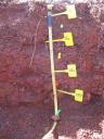
D11_OAES_Profile_000-046.JPG