| Print Date: Jul 22 2015 | Country: |
| Description Date: Jun 2 2014 | State: Utah |
| Describer: Randy Lewis; Ray Grow | County: Tooele |
| Site ID: 14UT611001RJL | MLRA: 28A -- Great Salt Lake Area |
| Site Note: | Soil Survey Area: UT611 -- Tooele Area, Utah - Tooele County and Parts of Box Elder, Davis and Juab Counties |
| Pedon ID: S2014UT045001 | Map Unit: 64 -- Taylorsflat loam, 1 to 5 percent slopes |
| Pedon Note: | Quad Name: Faust, Utah |
| Lab Source ID: KSSL | Std Latitude: 40.1783389 |
| Lab Pedon #: 14N0856 | Std Longitude: -112.4538139 |
| User Transect ID: | |
| Soil Name as Described/Sampled: Taylorsflat | |
| Classification: Fine-loamy, mixed, superactive, mesic Xeric Haplocalcids | Latitude: 40 degrees 10 minutes 42.02 seconds north |
| Soil Name as Correlated: | Longitude: 112 degrees 27 minutes 13.73 seconds west |
| Classification: | Datum: WGS84 |
| Pedon Type: correlates to named soil | UTM Zone: 12 |
| Pedon Purpose: research site | UTM Easting: 376224 meters |
| Taxon Kind: series | UTM Northing: 4448565 meters |
| Associated Soils: |
| Physiographic Division: | Primary Earth Cover: Shrub cover |
| Physiographic Province: | Secondary Earth Cover: Shrubby rangeland |
| Physiographic Section: | Existing Vegetation: cheatgrass, mountain big sagebrush, mustard, rabbitbrush, scarlet globemallow, squirreltail |
| State Physiographic Area: | Parent Material: eolian deposits over slope alluvium derived from limestone and sandstone |
| Local Physiographic Area: | Bedrock Kind: |
| Geomorphic Setting: fan remnant | Bedrock Depth: |
| Upslope Shape: concave | Bedrock Hardness: |
| Cross Slope Shape: convex | Bedrock Fracture Interval: |
| Particle Size Control Section: 25 to 100 cm. | Surface Fragments: |
| Description origin: NASIS | Description database: KSSL |
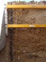
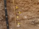
 D15_ONAQ_Profile_000-200.JPG
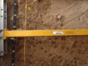
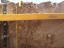