| Print Date: Jul 22 2015 | Country: United States |
| Description Date: Jan 13 2014 | State: Alabama |
| Describer: Milton Tuck, Lawrence McGhee | County: Bibb |
| Site ID: S2014AL007001 | MLRA: 133A -- Southern Coastal Plain |
| Site Note: | Soil Survey Area: |
| Pedon ID: S2014AL007001 | Map Unit: MsF -- Maubila-Smithdale complex, 15 to 35 percent slopes |
| Pedon Note: | Quad Name: Payne Lake, Alabama |
| Lab Source ID: KSSL | Std Latitude: 32.9510611 |
| Lab Pedon #: 14N0297 | Std Longitude: -87.3941000 |
| User Transect ID: | |
| Soil Name as Described/Sampled: Smithdale | |
| Classification: Fine-loamy, siliceous, subactive, thermic Typic Hapludults | Latitude: 32 degrees 57 minutes 3.82 seconds north |
| Soil Name as Correlated: | Longitude: 87 degrees 23 minutes 38.76 seconds west |
| Classification: | Datum: WGS84 |
| Pedon Type: confirmation description | UTM Zone: 16 |
| Pedon Purpose: research site | UTM Easting: 463164 meters |
| Taxon Kind: series | UTM Northing: 3645931 meters |
| Associated Soils: Boykin, Maubila |
| Physiographic Division: | Primary Earth Cover: Tree cover |
| Physiographic Province: | Secondary Earth Cover: |
| Physiographic Section: | Existing Vegetation: |
| State Physiographic Area: | Parent Material: thick beds of loamy marine sediments |
| Local Physiographic Area: | Bedrock Kind: |
Geomorphic Setting: on backslope of side slope of coastal plain
on backslope of side slope of coastal plain | Bedrock Depth: |
| Upslope Shape: convex | Bedrock Hardness: |
| Cross Slope Shape: linear | Bedrock Fracture Interval: |
| Particle Size Control Section: 37 to 78 cm. | Surface Fragments: |
| Description origin: NASIS | Description database: KSSL |
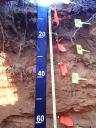
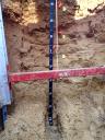
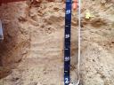
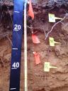
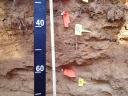
 D08_TALL_Profile_000-062.JPG
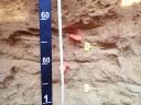
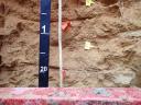