D05 UNDE Megapit Soils Description


PEDON DESCRIPTION
Print Date: Jul 22 2015 Country:
Description Date: Sep 9 2013 State: Michigan
Describer: Ryan Bevernitz, Lily Palmer, J Scott Eversoll County: Gogebic
Site ID: 2013MI053001 MLRA: 93B -- Superior Stony and Rocky Loamy Plains and Hills, Eastern Part
Site Note: NEON site Soil Survey Area: 10-RHI -- Rhinelander, Wisconsin
Pedon ID: S2013MI053001 Map Unit: 5172C -- Gogebic, sandy substratum-Pence-Cathro complex, 0 to 18 percent slopes
Pedon Note: Quad Name: Tenderfoot Lake, Wisconsin
Lab Source ID: KSSL Std Latitude:
Lab Pedon #: 13N97284 Std Longitude:
User Transect ID:  
Soil Name as Described/Sampled: Tula  
Classification: Coarse-loamy, mixed, superactive, frigid Argic Fragiaquods Latitude: 46 degrees 14 minutes 10.40 seconds north
Soil Name as Correlated: Longitude: 89 degrees 32 minutes 20.90 seconds west
Classification: Datum: NAD83
Pedon Type: confirmation description UTM Zone:
Pedon Purpose: research site UTM Easting:
Taxon Kind: series UTM Northing:
Associated Soils:
Physiographic Division: Primary Earth Cover: Tree cover
Physiographic Province: Secondary Earth Cover: Intermixed conifers and hardwoods
Physiographic Section: Existing Vegetation: arctic bentgrass, balsam fir, beaked hazelnut, bedstraw, big red stem moss, black cherry, bristly dewberry, bunchberry dogwood, Canada mayflower, common ladyfern, eastern marsh fern, eastern teaberry, elderberry, goldenrod, groundcedar, hawkweed, paper birch, partridgeberry, quaking aspen, rare clubmoss, red maple, sarsaparilla, sedge, speckled alder, sphagnum, starflower, western brackenfern, white spruce, woodfern, Yakima bird's-beak
State Physiographic Area: Parent Material:
Local Physiographic Area: Bedrock Kind:
Geomorphic Setting: on backslope of side slope of disintegration moraine on till plain
on backslope of side slope of tree-tip mound
Bedrock Depth:
Upslope Shape: concave Bedrock Hardness:
Cross Slope Shape: linear Bedrock Fracture Interval:
Particle Size Control Section: Surface Fragments: flat subrounded indurated 250- to 600-millimeter
Description origin: NASIS Description database: KSSL
Diagnostic Features: ? to ? cm.


Cont. Site ID: 2013MI053001 Pedon ID: S2013MI053001


Slope (%) Elevation (meters) Aspect (deg) MAAT (C) MSAT (C) MWAT (C) MAP (mm) Frost-Free Days Drainage Class Slope Length (meters) Upslope Length (meters)
4.0 1,680.0 270           somewhat poorly    

A--0 to 8 centimeters (0.0 to 3.1 inches); dark brown (7.5YR 3/3) sandy loam; weak fine granular structure; very friable; very fine roots and medium roots and fine roots and coarse roots; 3 percent nonflat subrounded indurated 76 to 250-millimeter unspecified fragments; clear smooth boundary. Lab sample # 13N12314. A and Bs might be from a tree throw

Bs--8 to 15 centimeters (3.1 to 5.9 inches); brown (7.5YR 4/4) sandy loam; weak medium subangular blocky structure; very friable; very fine roots and medium roots and fine roots; clear smooth boundary. Lab sample # 13N12315

E--15 to 23 centimeters (5.9 to 9.1 inches); brown (7.5YR 5/2) sandy loam; moderate thin platy parts to moderate medium subangular blocky structure; friable; medium roots and fine roots; 35 percent distinct 5YR 5/3), moist, silt coats on all faces of peds; 1 percent medium prominent 7.5YR 5/8) masses of oxidized iron on surfaces along root channels and 10 percent medium prominent 7.5YR 5/8) masses of oxidized iron on faces of peds; clear smooth boundary. Lab sample # 13N12316. a thin a horizon at the top of the horizon

B's1--23 to 31 centimeters (9.1 to 12.2 inches); dark reddish brown (5YR 3/4) fine sandy loam; strong coarse angular blocky structure; friable; very fine roots and fine roots; clear smooth boundary. Lab sample # 13N12317

B's2--31 to 48 centimeters (12.2 to 18.9 inches); brown (7.5YR 4/4) fine sandy loam; strong coarse angular blocky structure; friable; very fine roots and fine roots; clear smooth boundary. Lab sample # 13N12318

E/Bx--48 to 57 centimeters (18.9 to 22.4 inches); 60 percent reddish gray (5YR 5/2) and 40 percent reddish brown (2.5YR 4/4) fine sandy loam; strong fine subangular blocky structure; hard, firm; brittle; very fine roots and medium roots and fine roots and coarse roots; fine low-continuity vesicular pores; abrupt irregular boundary. Lab sample # 13N12319. A and Bs might be from a tree throw

2Bt1--57 to 83 centimeters (22.4 to 32.7 inches); reddish brown (2.5YR 4/4) silty clay; strong fine subangular blocky structure; very firm; fine roots; 3 percent distinct 5YR 5/3), moist, silt coats on all faces of peds and 10 percent faint 2.5YR 4/3), moist, clay films on all faces of peds; gradual wavy boundary. Lab sample # 13N12320

2Bt2--83 to 114 centimeters (32.7 to 44.9 inches); reddish brown (2.5YR 4/4) silty clay loam; strong fine subangular blocky structure; very firm; fine roots; and 3 percent distinct 5YR 5/3), moist, silt coats on all faces of peds and 10 percent faint 2.5YR 4/3), moist, clay films on all faces of peds; clear wavy boundary. Lab sample # 13N12321

2C1--114 to 147 centimeters (44.9 to 57.9 inches); reddish brown (2.5YR 4/4) silty clay loam; structureless massive; very friable; fine roots; 1 percent nonflat subrounded indurated 2 to 76-millimeter unspecified fragments; abrupt smooth boundary. Lab sample # 13N12322. few 5YR 5/3 lfs lfs strata 1cm think on average

3C2--147 to 235 centimeters (57.9 to 92.5 inches); 60 percent red (2.5YR 4/6) and 30 percent dark red (2.5YR 3/6) and 10 percent weak red (10R 4/4) stratified loamy fine sand to fine sandy loam to silt loam; structureless massive; very friable; very fine roots and fine roots; . Lab sample # 13N12323


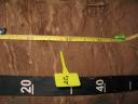
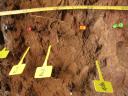
D05_UNDE_139-195.JPG
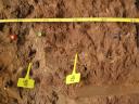
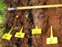
D05_UNDE_Profile_000-110.JPG

D05_UNDE_Profile_000-200.JPG

D05_UNDE_080-120.JPG

D05_UNDE_113-155.JPG

D05_UNDE_021-061.JPG

D05_UNDE_043-092.JPG

D05_UNDE_000-034.JPG